Enkel HTML-version


50
•
www.lackokinnekulle.se
sights and excursions
Sights and Excursions
%2
stola säteri
(63-f3)
In medieval times Gustav Vasa's faithful serv-
ant Anders Hasson lived at Stola. Anders was
given the name Ekeblad. The estate remained in
the Ekeblad family until
1808
. Open
27
t
h
June-
12
th
Aug. Wed, Thu, Sat and Sun at
14
o´clock
and also
14
th
July-
5
th
Aug. at
11
o´clock (not the
29
th
July at
11
o´clock).
www.stola.se
%3
storeberg
(62-c6)
The most intact estate environment in Lid-
köping's community. At one time this estate
had its own brick factory, dairy, and saw mill.
In the
1880
's sailing vessels were used to ship
grain to Gothenburg. One can visit the charm-
ing antique shop or café located on the estate.
%4
särnmarksbrunnen
(60-d4)
In
1856
A.P. Särnmarks donated this
well which provided clean water to the town.
Water was obtained from a pipe line that
travelled down from the hills in Råda. The well
house become the natural gathering place of
the town residents.
%5
villa giacomina
(63-g5)
Claes Julius Ekeblad of Stola Säteri moved here
in the
1780
s. Ekeblad constructed the English
park like gardens with meandering paths, broad
leaf trees, meadows, streams and a gazebo
overlooking Lake Vänern. Count Gustaf Piper
rebuild the main structure to resemble an
Italian villa.
%6
vänergaleasen mina
(60-d4)
This ship was built on the beach of the
island Torsö. It is considered one of the oldest
surviving ships that was not constructed in a
shipyard. Today it is owned by Vänergaleasen
Minas Association and open for viewing.
www.msmina.se
%7
vänermuseet
(60-b2)
The museum allows one to experience the natu-
ral history of Lake Vänern. The various exhibi-
tions of the museum reflect on the interaction
between the large lake and the development
within Lidköping. Open tues–fri
10–17
, sat–sun
12–17
, also open mondays june-aug.
www.vanermuseet.se
^5
hindens rev
(62-d4)
A long peninsula which extends into Lake
Vänern. Hinden’s reef measures
5
kilometres
in length and
25
to
100
meters in width. When
water levels are high five elongated islands are
formed. The reefs were formed during the last
Ice Age,
10,000
years ago.
^1
munkängarna
(58-d3)
This scenic area is home to most of Sweden's
hard wood trees. The ground is covered by a lay-
er of alum shale, the most fertile of Kinnekulle's
rock species. During the
15
th century Munkäng-
arna was owned by Vadstena Abbey. The English
style gardens were designed in the
18
th century.
^4
österplana hed
och vall
(58-d4)
The predominate physical feature of this area
is the bare limestone soil is found in very few
places around the world. In the spring one can
find purple orchids growing abundantlyy around
Österplana kyrka. Truly a beautiful environment.
Hiking Trails
kinnekulle & lidköping
map p. 58-59, 62
kinnekulle vandringsled
(58)
This
45
kilometre hiking trail takes about
two days to complete. This path offers a variety
of hiking terrain and travels along the west and
east sides of Kinnekulle. In some places shelters
are available for overnight stays.
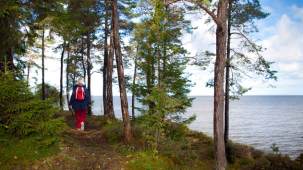
&0
källstorp
(62-d5)
Well marked paths lead out to the island and
beaches with barbecue sites. The paths are
marked in three different colours. Blue path is
5
kilometres, red is
2.5
km and the yellow path is
1.6
km Maps in the mailbox located in the
parking lot are available for
sek 20
each.
pilgrimsled kinnekulle
(58–59)
This trail goes between Husaby and
Forshem's churches, through a natural reserve,
along small byways and old rail road embank-
ments and through pastures. The trail is marked
with a pilgrim symbol, which links trails through-
out Sweden and Norway.
www.pilgrimskaraborg.se
Natural Reserves
kinnekulle & lidköping
map p. 58-59, 62
^5